
A friend recently asked us which weather files we find most useful in French Polynesia and I thought I would write it up as a post. Notice that we are not claiming to be weather experts, or FP experts. This is not necessarily the state of art, but after two years of being here, this is the state of affairs on Estrellita 5.10b.
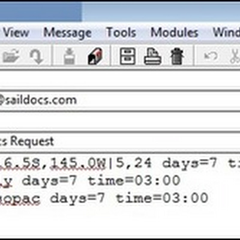
 First, we subscribe to three main files: a spot forecast for wherever we are, the Meteo France region forecast (fr.poly) by zone, and the Nadi Marine forecast for the South Pacific waters (nadi.sopac). We set the time for 0300Z so that when we check email in the good propagation in the evening we have the most recent weather already in our inbox. No need to request it.
Spot forecasts are based on the same models as the gribs and give you the forecast in your grid. If you don’t want to download a full grib they give you a good snapshot. Of course, you can’t see systems forming with a text snapshot of your location. Still, particularly in settled weather, they are enough for us. In the example above, we have requested a spot for our location which gives us a 5-day forecast for every 24 hours. We have subscribed for 7 days so we should get this same spot forecast for the next 7 days without re-requesting it, and it will be sent to us at 0300Z.
While the Meteo France forecast labels are clear for most regions, you will want to download the region map for the Tuamotus or at least memorize which zones you will be passing through. This is a short term forecast but very useful for the swell and for any “BMS” advisories (read at the top). It’s in French but with a few words translated you will be able to get the gist of it. If you don’t speak French, download one before you arrive and google translate a few of the key words. That will be plenty.
The Nadi SP forecast is a way to keep track of the fronts and convergence zones with text and is a great way to figure out if you might get smacked from the wrong direction or whether convergence zones or fronts (and the associated squalls and thunderstorms) are headed your way.
Second, often we also request a grib. We request a grib every few days in settled weather and at least once a day in unsettled weather or on passage. We always get the precipitation layer when we request a grib because the amount of grey (or black) is a good indicator for how squally an area will be.

Tip: If the grib shows light flukey wind switching from one direction to another, in our experience, this is how the models average out a front or some other type of system moving through. What you will often actually get is fairly strong wind, switching from one direction to its polar opposite and/or a lot of squalls.
Other files we request as needed:
There is a Meteo France file we call the "veil" (FRENCH_POLY) because it is weather, written almost in poetry and very difficult for someone who isn't fluent in French to read. It *is* very useful though because it has a longer forecast time period than the other Meteo France file and also because it talks more about systems and the swell.
We often get the Nadi fleet code (FIJI_FLTCODE). The plug in we have for OpenCPN is very useful to see the fronts. The only problem we have found is that we are running an older version of OpenCPN because our plug in won’t work in the newest version. If someone knows how to fix this, we would love to know.
In hurricane season we get the tropical disturbance (TD_SUMMARY) and tropical cyclone (TC_ADVISRY) summaries. It is useful to subscribe to those and then they will only be sent to you if they are updated. It’s a little unnerving if you haven’t received one in a while (is my subscription still working?) so we will occasionally request a single one just to check for a return email to our request saying “no updated file available”.


Thanks great info!!
ReplyDeleteChuck
Jacaranda
Glad it was helpful!
Delete